How Hard Is the Laguna de los Tres Hike?
Laguna de los Tres difficulty: 25 km and 8 to 9 hours there and back (APN), a 750 m height difference on the park leaflet, and a very steep last climb above the Poincenot camp.
Laguna de los Tres is a hard day out, but most of the difficulty sits in one place. The national park puts the whole walk at 25 km there and back, 8 to 9 hours, medium-high difficulty. On the park’s own figures the path climbs for the first hour or so, then barely gains height on the way to the Poincenot camp. The last climb from the camp to the lagoon is very steep, and the park’s own leaflet warns that it is dangerous when it is windy and rainy. If you are fit enough for a long day on your feet and you take the last hour slowly, you can do it.
See the guided day with two turnaround points
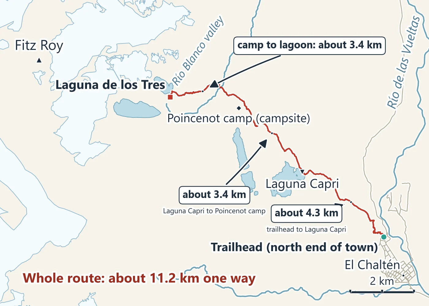
Distance and time, section by section
The park’s North Zone trail leaflet (English edition, 2024) gives each stop as a time, a height and a distance from the trailhead, one way:
| From the trailhead | Time, one way | Height column | Distance |
|---|---|---|---|
| Río de las Vueltas viewpoint | 0:20 | 100 m | 0.7 km |
| Laguna Capri | 1:45 | 350 m | 4 km |
| Poincenot camp | 2:45 | 350 m | 8 km |
| Laguna de los Tres | 5:00 | 750 m | 10 km |
Source: Los Glaciares National Park, North Zone trail leaflet (Administración de Parques Nacionales, English edition, 2024), read November 2026. The leaflet adds about 20 minutes and 2 km from the park visitor centre to the start of the trail.
Read the height column as the height gained since the trailhead (the Spanish edition heads it “desnivel”): the same 350 m at Capri and at Poincenot means the stretch between them barely climbs, and the last 2 km to the lagoon add another 400 m. The leaflet’s Spanish edition of 2022 gives the same 750 m and 10 km, with 4 hours for the walk to the lagoon.
Other counts differ a little. The APN’s activities page gives 25 km and 8 to 9 hours for the round trip. The El Chaltén tourism office gives 4 hours each way and rates the walk high difficulty (its page dates from 2016). Our own map, measured along the drawn path, gives about 11.2 km one way. None of these is wrong; they start from different points and walk at different speeds.
The last climb
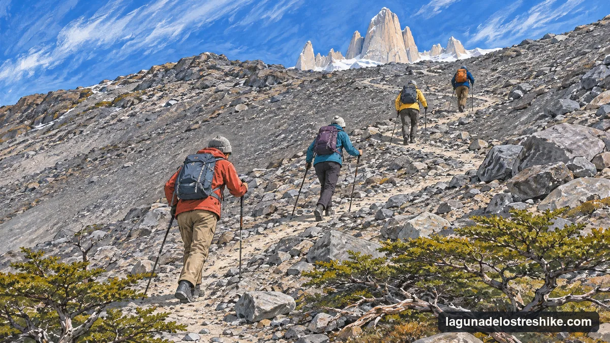
The tourism office describes the start of the last hour of ascent at the river crossing beside the Poincenot camp. From there the path goes up the moraine to the rim of the lagoon. The leaflet’s words for it are “Very steep trail. Dangerous when it’s windy and rainy.” On Azul Latina Travel’s guided day the section is about 430 m of climbing over nearly 3 km; On Patagonia Adventures’ newer guided trek describes a demanding push over high-mountain terrain that may include rock, water, snow or ice.
What that means in practice:
- You come down the same steep path you went up. The guided days hand out trekking poles.
- In wind and rain the climb is exposed. The guided days decide on the spot whether to go up, and Azul Latina Travel’s day sends anyone unsure to Laguna Capri with a second guide.
- Snow or ice can lie on the last stretch, which is why the guided days carry crampons “if needed”.
Who it suits
The guided listings set their own limits, and they are a fair yardstick. Azul Latina Travel’s day is for ages 10 to 55, though not strictly for older hikers who trek regularly, and calls it a medium to high physical-demand activity. It is not for people with back, heart or breathing problems or high blood pressure. Say Hueque Travel’s trek is for hikers with a high level of fitness.
If you are not sure, stop at Laguna Capri: about 4 km from the trailhead with the same Fitz Roy skyline across the water, and the whole Capri walk takes about 3:30 hours there and back on the tourism office’s figure.
Height of the mountain
Fitz Roy itself is 3,405 m on the park leaflet’s map, the figure the tourism office also gives. The lagoon sits at its foot, under the Glaciar de los Tres. You do not climb the mountain on this hike; you walk to the lagoon below it.
Doing it with a guide
A guide does not make the last hour less steep. What a guided day adds is the decision: someone who knows the trail judges the wind on the moraine, and a second guide gives anyone who stops a safe way back.
The calendar is Azul Latina Travel’s day from El Calafate, from US$395 a person (checked November 2026). At least two people must book together, and the booking cannot be refunded. The park pass is extra.
Around El Chaltén
More Days Out from El Calafate and El Chaltén
Hikes, day trips and boats in the north of the park with live availability. What each includes and its cancellation terms show before you book.
Two Guides, Two Turnaround Points
On Azul Latina Travel's day from El Calafate one guide takes the group to Laguna de los Tres and the other walks anyone unsure to Laguna Capri. At least two people per booking; non-refundable. The park pass is extra.
Check dates